Lightning flash report 2025
Europe / France
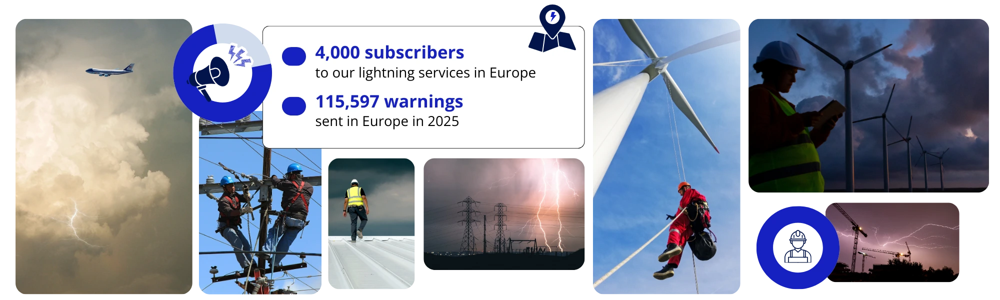
Discover Meteorage’s analysis of thunderstorm and electrical activity over the year.
Joris Royet, Chef de projet Météo, METEORAGE
2025 stands out as a year with historically few thunderstorms,
marked by generally low electrical activity across Europe, but punctuated by locally intense episodes.
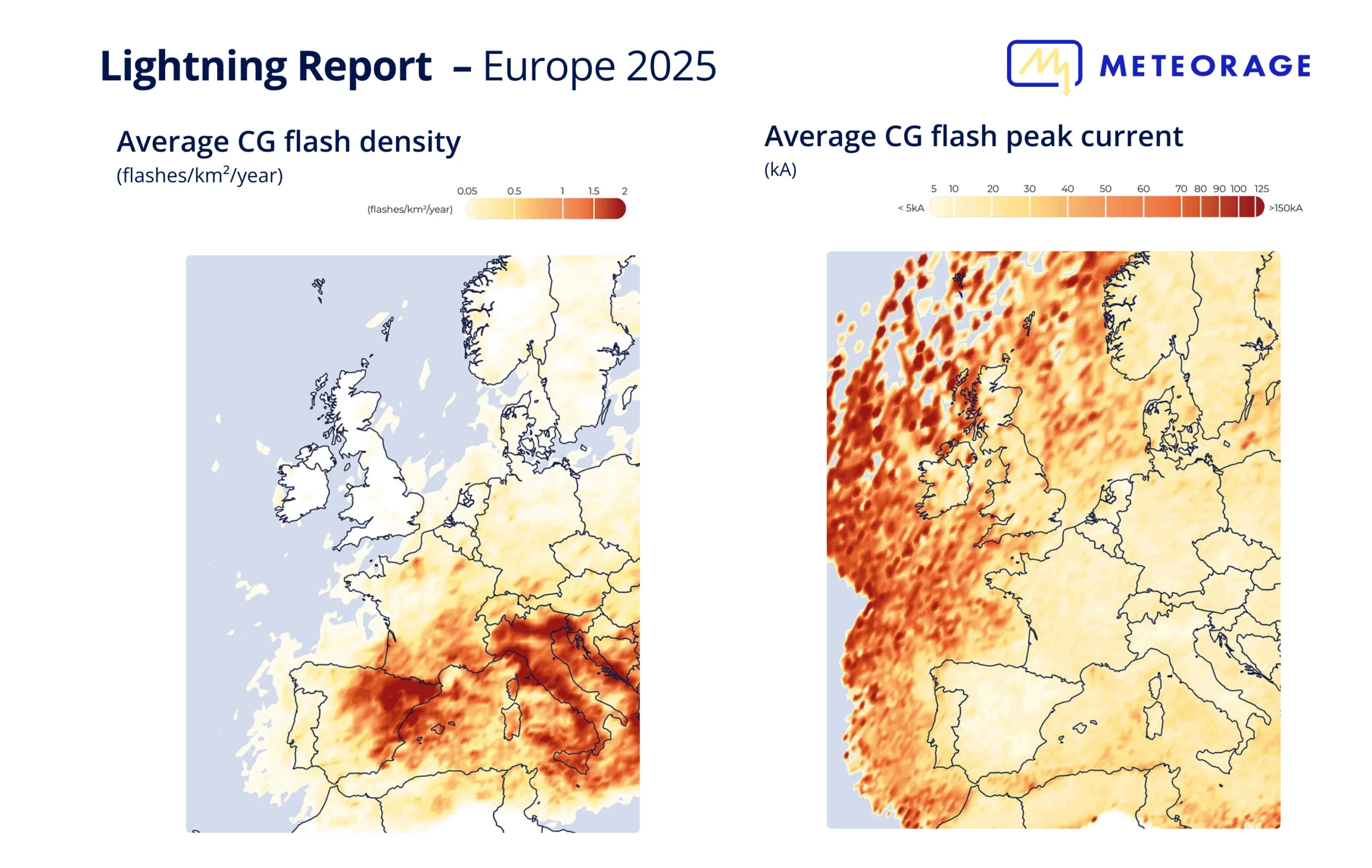
With around 1.226 million cloud-to-ground lightning flashes detected in Europe, 2025 stands out for its thunderstorm activity below the climate normals, making it the year with the fewest lightning flashes observed to date by our Meteorage records. Although the atmospheric conditions limited the development of thunderstorms, some favourable situations nevertheless gave rise to intense, localised episodes, with more marked activity around the Mediterranean basin and on higher ground.
Beyond this report and the spatial distribution observed in 2025, analyses covering the past twenty years highlight a gradual northward shift of the thunderstorm belt, as well as a lengthening of the thunderstorm season, marked by earlier episodes in spring and later occurrences in autumn. These regional disparities are a reminder that lightning is never uniformly distributed and that, even in years when there is little activity, the issues of prevention, surveillance and lightning risk management remain fully relevant.

Our Meteorage lightning detection network recorded in 2025
These values contrast with 2024, when more than 1,967,112 cloud-to-ground lightning flashes were detected in Europe, including 413,879 in France, reflecting activity in line with climate normals.

The number of lightning flashes from one year to the next does not in itself reflect the level of danger.
In 2025, there were fewer thunderstorms in Europe, but they were just as intense in some cases, and the risk to exposed activities could appear at any time.
— Stéphane Schmitt, Lightning Application Expert, Meteorage
Key facts
Although lightning flash activity in 2025 was below historical averages, the high interannual variability of thunderstorm activity does not yet allow a robust statistical trend to be identified.
360 days with thunderstorms
Most of the storm activity was concentrated between June and August (64%), when unstable conditions were most favourable, with a marked peak in June and almost 284,200 cloud-to-ground lightning flashes recorded across the continent, illustrating a sometimes early thunderstorm season.
In 2025, atmospheric circulation at European level favoured a concentration of convective activity around the Mediterranean.
The recurrent presence of high geopotentials over central and northern Europe limited the advance of unstable systems towards the north of the continent.
As a result, low-pressure circulations and dynamic forcing remained at low latitudes, interacting with warmer, more humid air masses around the Mediterranean, creating an environment more favourable to electrical activity.
— Joris Royet, Weather Project Manager, Meteorage
Top 10 most lightning-struck countries in Europe in 2025
The frequency, geographical distribution and intensity of thunderstorms vary with the seasons, depending on temperature, humidity and atmospheric dynamics.
The spring season totalled 233,316 cloud-to-ground lightning flashes, with very heterogeneous geographical distribution: little activity over the northern half of Europe, which remained largely under the influence of persistent anticyclonic conditions, greatly limiting the development of thunderstorms. Conversely, there was more regular activity in the south of the continent, particularly around the Mediterranean basin.
During this period, Spain was the country most affected, with 97,219 cloud-to-ground lightning flashes.
Summer saw 775,394 cloud-to-ground lightning flashes, representing more than half of the annual activity.
Although the thunderstorms developed mainly along the classic Spain – France – Germany axis, Italy also saw significant activity, becoming the country most struck by lightning in Europe during this season.
In the autumn, thunderstorms continued mainly:
- over the seas,
- over Mediterranean coastal regions (eastern Spain, southern France, Italy).
This local intensification is explained by the persistence of warm surface waters, while the lower continental layers cooled more rapidly. This vertical temperature contrast favoured convection, making thunderstorms sometimes intense and very rainy, depending on the passage of low-pressure systems.
Key facts
A year with few lightning flashes and more activity in the south
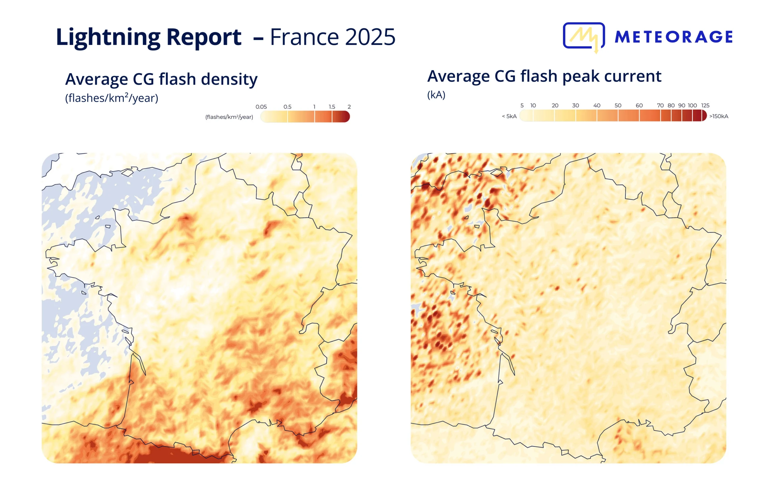
In this European context, France is fully in line with the trend, with 267,502 cloud-to-ground lightning flashes detected, a year below normal climatic conditions. Activity was concentrated in a few periods and varied greatly from region to region.
The summer of 2025 thus became the least lightning-stricken since the beginning of the century, with 175,000 cloud-to-ground lightning flashes, despite the occasional occurrence of severe thunderstorms. June was the peak month of the season, with 78,300 cloud-to-ground lightning flashes, driven in particular by the exceptional episode on 13 June, with 19,000 cloud-to-ground lightning flashes concentrated in a few regions (Normandy, Nouvelle-Aquitaine, Hauts-de-France).
As a result, low-pressure systems and dynamic forcing persisted at low latitudes, interacting with warmer, more humid air masses around the Mediterranean, creating an environment more conducive to electrical activity.
253 days with thunderstorms
Top 10 regions most affected by lightning flashes in France in 2025
by number of cloud-to-ground (CG) lightning flashes
Move over the graph to view the data.
by lightning density of cloud-to-ground (CG) lightning flashes per km²/year
| 01. Corse | 0,98 |
| 02. Provence-Alpes-Côte d'azur | 0,90 |
| 03. Occitanie | 0,78 |
| 04. Auvergne-Rhône-Alpes | 1,68 |
| 05. Nouvelle Aquitaine | 0,49 |
| 06. Bourgogne-Franche Comté | 0,48 |
| 07. Normandie | 0,37 |
| 08. Grand-Est | 0,35 |
| 09. Ile de France | 0,29 |
| 10. Centre-Val de Loire | 0,20 |
Top 10 departments most affected by lightning flashes
by number of cloud-to-ground (CG) lightning flashes
Move over the graph to view the data.
by lightning density of cloud-to-ground (CG) lightning flashes per km²/year
| 01. PYRENEES-ORIENTALES (Occitanie) | 1,39 |
| 02. GARD (Occitanie) | 1,23 |
| 03. VAUCLUSE (Provence-Alpes-Côte d'azur) | 1,09 |
| 04. HAUTE-CORSE (Corse) | 1,07 |
| 05. VAR (Provence-Alpes-Côte d'azur) | 1,00 |
| 06. ARDECHE (Auvergne-Rhône-Alpes) | 0,97 |
| 07. ALPES-DE-HAUTE-PROVENCE (Provence-Alpes-Côte d'azur) | 0,96 |
| 08. PYRENEES-ATLANTIQUES (Nouvelle Aquitaine) | 0,95 |
| 09. BOUCHES-DU-RHONE (Provence-Alpes-Côte d'azur) | 0,95 |
| 10. DROME (Auvergne-Rhône-Alpes) | 0,93 |
Top 10 municipalities most affected by lightning flashes
by number of cloud-to-ground (CG) lightning flashes
Move over the graph to view the data.
by lightning density of cloud-to-ground (CG) lightning flashes per km²/year
| 01. MOULEZAN (GARD) | 5,08 |
| 02. BOURG-LE-ROI (SARTHE) | 4,68 |
| 03. NOHANENT (PUY-DE-DOME) | 4,42 |
| 04. CAMPI (HAUTE-CORSE) | 4,41 |
| 05. RONCHEROLLES-SUR-LE-VIVIER (SEINE-MARITIME) | 4,39 |
| 06. MONTAGNA-LE-RECONDUIT (JURA) | 4,33 |
| 07. RUSIO (HAUTE-CORSE) | 4,29 |
| 08. TASSO (CORSE-DU-SUD) | 4,23 |
| 09. PIEDIGRIGGIO (HAUTE-CORSE) | 4,22 |
| 10. COMBAS (GARD) | 4,18 |
Spring is characterised by significant geographical disparities:
The northern regions remain largely unaffected by storm activity.
The south of the country experiences more frequent storms, although these do not reach significant levels on a national scale.
The plains of the south-west and certain areas of the centre-east are among the most affected, with storms that are sometimes prolonged and locally accompanied by hail, encouraged by low-pressure systems over the Atlantic.
Despite a few occasional violent episodes, the summer of 2025 is characterised by very low electrical activity:
Storm damage remains rare and often localised.
The east of the country continues to experience moderate activity.
The Atlantic coast and a large part of the north-west remain largely unaffected by storms.
This situation is explained by the recurring presence of anticyclonic conditions, limiting convection and the formation of storms.
The result: 175,000 cloud-to-ground lightning flashes over the entire summer, making 2025 the summer with the fewest lightning strikes since the beginning of the century. i.e. the annual majority.
Autumn remained generally calm in terms of storms. However, the following events were noted:
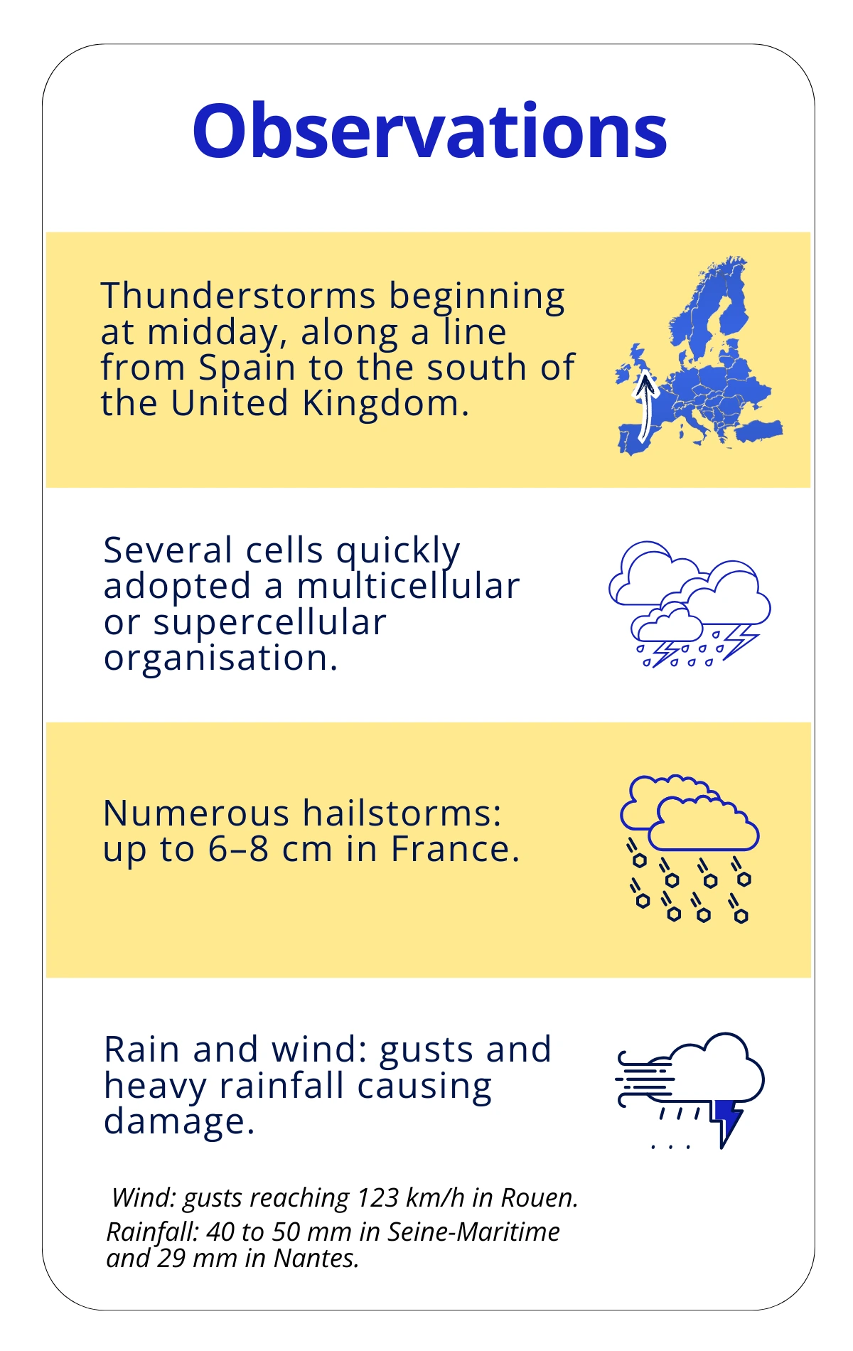
- The passage of a supercell in northern France, which caused a tornado in Ermont (Val-d’Oise).
- A few more typical rain and storm episodes in the south-east, without any notable excess of electrical activity.
Case study
13 June, the stormiest day of the year in Europe
by Joris Royet, Weather Project Manager, Meteorage.
13 June 2025 was the most intense electrical event of the year, both in France and across Europe. Across Europe, more than 30,650 cloud-to-ground lightning flashes were recorded, including nearly 19,000 in France, making this day the annual peak for lightning strikes.
An extraordinary day in a quiet year
On 13 June 2025, a synoptic configuration particularly conducive to deep convection develops over Western Europe.
An anticyclonic ridge extends from France to Scandinavia, while vast low-pressure systems circulate over the Atlantic and Central Europe. This configuration created a large area of thermal contrast, with very warm air in the lower layers and marked cooling at altitude → rapid formation of storm clouds.
To the west, a dynamic trough progressed from the Atlantic and tended to isolate itself as a cold drop. Ahead of it, a warm and humid south to south-westerly flow brought a very unstable air mass.
The instability is reinforced by an upper-level forcing, via the presence of a divergent jet stream branch, favouring the rapid vertical extension of cumulonimbus clouds.
In the lower layers, conditions are also favourable:
- Marked wind convergence
- Significant shear
- High rotational indices
In summary: all the ingredients were in place for the formation of intense thunderstorms.
In 2025, atmospheric circulation across Europe favoured a concentration of convective activity around the Mediterranean. The recurring presence of high geopotential systems over central and northern Europe limited the progression of unstable systems towards the north of the continent. As a result, low-pressure circulation and dynamic forcing remained at low latitudes, interacting with warmer, more humid air masses around the Mediterranean, creating an environment more conducive to electrical activity.
— Joris Royet, Weather Project Manager, Meteorage.
Electrical report
30,650 cloud-to-ground lightning flashes detected in Europe
These figures show a high level of activity and exceptional dynamism observed on that day.
→ This episode had a significant impact on several regions of France:
- Normandy: more than 6,150 cloud-to-ground lightning flashes, a regional annual record, with a high density between Eure, Seine-Maritime and Val-d’Oise.
- Hauts-de-France: more than 1,600 cloud-to-ground lightning flashes in the evening, a level much higher than other episodes during the year.
- Nouvelle-Aquitaine: nearly 6,000 cloud-to-ground lightning flashes, also an annual maximum.

2025, a quiet year, but real impacts.
Major accidents in 2025
Energy : wind turbines damaged or destroyed by lightning in the Netherlands, Spain and France, causing fires and major economic losses.
Transport : delays and interruptions to air travel (Orly and CDG airports) and rail travel in France, Germany and the UK following strikes on signalling systems.
Industry : business stoppages and damage to property following direct strikes on industrial sites (distillery and workshops in France) and leisure infrastructures (cable car in Italy).
Agriculture : mortality of sometimes entire herds in Spain and Ireland
Environment: at least two major forest fires were started by lightning, in Switzerland (Ticino) and Portugal (Coimbra district)
LOW ACTIVITY ≠ LOW RISK
Although 2025 was less stormy than normal at European level, the risk from lightning remained very real. The fall in the total number of lightning flashes does not automatically reduce exposure, which affects many sectors of activity.
Any thunderstorm, even a moderate one, can cause major and sometimes unexpected damage, including business stoppages, damage to sensitive equipment, economic losses or human risks.
A permanent risk, without borders or seasons
An analysis of the accidents which occurred in 2025 confirms that the consequences of lightning are not limited to extreme situations or to the summer period alone. The events recorded are spread throughout the year, demonstrating that the risk is permanent, even for phenomena considered minor. It is crucial to remember that the majority of serious accidents occur on days with a yellow weather warning, or even without any particular warning.
The accident at La Barben zoo (France) which occurred on a stormy but far from exceptional day, is a striking illustration of this.
This underlines the need for constant vigilance, even during episodes described as “moderate”.
Prevention for better protection
In response to this widespread risk, adopting appropriate preventive measures is essential with regard to raising awareness, the organisation of outdoor activities, protecting infrastructures and disseminating best practice to exposed teams.
With this in mind, Meteorage helps its customers and partners to protect themselves better, with training, lightning data, and warning, analysis and decision-making services. This expertise is also part of a wider mission to disseminate a risk culture through our commitment to standardisation, our international studies and publications, as well as educational initiatives and prevention messages accessible to all.
At Meteorage, we help our customers anticipate, monitor and manage thunderstorm risks with solutions tailored to each sector of activity.
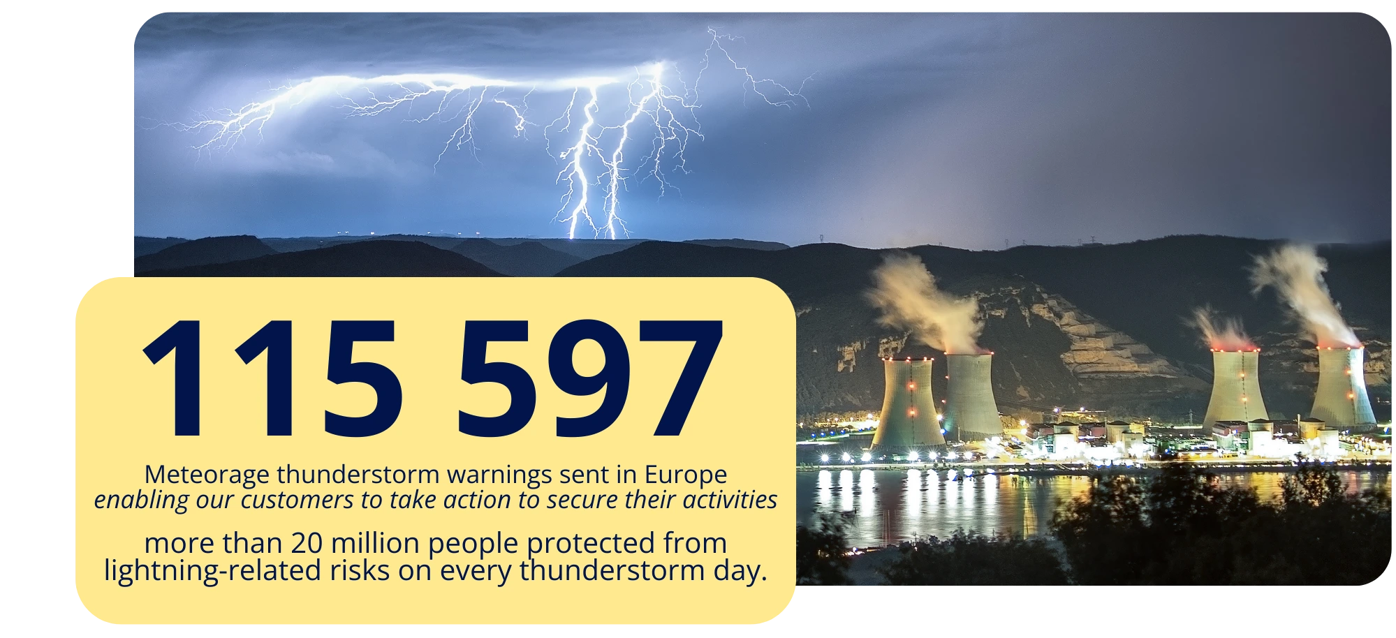
Every day, our data enables our customers to schedule planned stoppages, protect their on-site teams, ensure continuity of service and secure their priority operations.
Terminology
To help you better understand the information in this report, here are the definitions for some of the most frequently used terms.
Cloud-to-ground (CG) lightning flash
Discharge of current of a certain intensity circulating between the cloud and the ground. Abbreviated to CG (Cloud-to-Ground).
Lightning density
The best current representation of thunderstorm activity is lightning density, which is the number of cloud-to-ground (CG) lightning flashes per km² per year.
Lightning flash
All current discharges and electrical impulses from a lightning event. A lightning flash can occur within the same cloud (IC), between a cloud and the ground (CG) or between two clouds (CC). A lightning flash can be composed of one stroke or many strokes, which are current discharges and electrical impulses.
Thunder day
Each day that lightning was detected in a given area.
About this lightning report
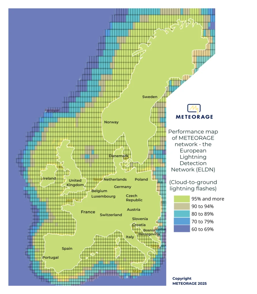
The lightning report is based on data provided by the METEORAGE network – the European Lightning Detection Network (ELDN).
The information we provide concerns cloud-to-ground (CG) lightning flashes and lightning density.
To be able to compare these data with the data collected, METEORAGE counts the main current pulse circulating between the cloud and the ground, defined in this report by the term “Cloud-to-ground (CG) lightning flash”.
Our expertise draws on more than ten years of analysis, observation and data collected in Europe, and more broadly worldwide. We have over 37 years’ expertise in France.
The performance of our network has been validated scientifically and delivers the best possible results with:
- > 98% lightning flash detection,
- a median detection accuracy of 100 meters,
- > 90% distinction made between cloud-to-ground (CG) lightning flashes and intra-cloud lightning flashes.
The METEORAGE network (ELDN) consists of more than 100 lightning sensors, calculators and a processing system that manages the databases. Our lightning sensors are based on the Vaisala technology, currently considered one of the best in the world. Our network achieves levels of performance validated by numerous scientific studies and publications.
This 2024 report is based on the most comprehensive source of information in the United Kingdom. The data, densities, rankings and thunder days in this report are dated from 1 January 2024 to 31 December 2024.
Discover the lightning density of a location
View the density of lightning strikes over the last 10 years in your region, your département and your commune on our interactive map of lightning strikes in France.
Zoom in (top left) to see your region, your département and the town with the most and least lightning strikes. Or enter a specific address in the search bar (top right). You can also buy lightning data for your locality online.
Terminology
To help you better understand the information in this report, here are the definitions for some of the most frequently used terms.
Cloud-to-ground (CG) lightning flash
Discharge of current of a certain intensity circulating between the cloud and the ground. Abbreviated to CG (Cloud-to-Ground).
Lightning density
The best current representation of thunderstorm activity is lightning density, which is the number of cloud-to-ground (CG) lightning flashes per km² per year.
Lightning flash
All current discharges and electrical impulses from a lightning event. A lightning flash can occur within the same cloud (IC), between a cloud and the ground (CG) or between two clouds (CC). A lightning flash can be composed of one stroke or many strokes, which are current discharges and electrical impulses.
Thunder day
Each day that lightning was detected in a given area.
About this lightning report
The lightning report is based on data provided by the METEORAGE network – the European Lightning Detection Network (ELDN).
The information we provide concerns cloud-to-ground (CG) lightning flashes and lightning density.
To be able to compare these data with the data collected, METEORAGE counts the main current pulse circulating between the cloud and the ground, defined in this report by the term “Cloud-to-ground (CG) lightning flash”.
Our expertise draws on more than ten years of analysis, observation and data collected in Europe, and more broadly worldwide. We have over 37 years’ expertise in France.
The performance of our network has been validated scientifically and delivers the best possible results with:
- > 98% lightning flash detection,
- a median detection accuracy of 100 meters,
- > 90% distinction made between cloud-to-ground (CG) lightning flashes and intra-cloud lightning flashes.
The METEORAGE network (ELDN) consists of more than 100 lightning sensors, calculators and a processing system that manages the databases. Our lightning sensors are based on the Vaisala technology, currently considered one of the best in the world. Our network achieves levels of performance validated by numerous scientific studies and publications.
This 2024 report is based on the most comprehensive source of information in France. The data, densities, rankings and thunder days in this report are dated from 1 January 2025 to 31 December 2025.